
Litratu:Spain Madrid location map.svg

Size of this PNG preview of this SVG file: 512 × 553 pixels. Other resolutions: 222 × 240 pixels | 444 × 480 pixels | 711 × 768 pixels | 948 × 1,024 pixels | 1,896 × 2,048 pixels.
Magåhet mineddong-ña (Atkibu SVG, 512 × 553 na pixels, mineddong atkibu: 199 KB)
Sumaria
| Description |
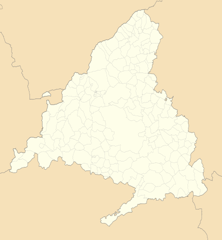
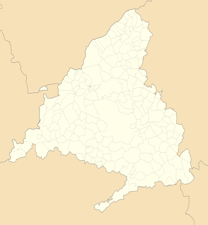
English: Location map of Community of Madrid
Equirectangular projection, N/S stretching 130 %. Geographic limits of the map:
Español: Mapa de localización de la Comunidad de Madrid
Proyección equirrectangular, N/S estirada 130 %. Límites geográficos del mapa:
|
|
| Date | ||
| Source | Own work based on: EspañaLoc.svg by HansenBCN | |
| Author | Miguillen | |
| Other versions |
|
|
| SVG genesis | This locator map was created with Inkscape.
|


Licensing
Miguillen, the copyright holder of this work, hereby publishes it under the following license:
This file is licensed under the Creative Commons Attribution-Share Alike 3.0 Unported license.
Attribution: Miguillen
- You are free:
- to share – to copy, distribute and transmit the work
- to remix – to adapt the work
- Under the following conditions:
- attribution – You must give appropriate credit, provide a link to the license, and indicate if changes were made. You may do so in any reasonable manner, but not in any way that suggests the licensor endorses you or your use.
- share alike – If you remix, transform, or build upon the material, you must distribute your contributions under the same or compatible license as the original.
Historian atkibu
Yemme' i fecha/ora para un li'e' i atkibu annai annok guihi na momentu.
| Fecha/Ora | Thumbnail | Mineddong | Muna'sesetbi | Komentu | |
|---|---|---|---|---|---|
| pa'go | 09:43, 20 Måyu 2010 | | 512 × 553 (199 KB) | Miguillen | == {{int:filedesc}} == {{Information |Description={{en|Location map of Community of Madrid}} Equirectangular projection, N/S stretching 130 %. Geographic limits of the map: * N: 41.221046° N * S: 39.804255° N * W: 4.64749 |
Inachetton dokumento
Umachetton i sigiente 2 na påhina siha yan este na atkibu:
Global file usage
The following other wikis use this file:
- Usage on ar.wikipedia.org
- Usage on ast.wikipedia.org
- Usage on azb.wikipedia.org
- Usage on ba.wikipedia.org
- Usage on be.wikipedia.org
- Usage on bg.wikipedia.org
- Usage on ca.wikipedia.org
- Usage on ceb.wikipedia.org
- Usage on ce.wikipedia.org
- Мадрид
- Кеп:Меттиган карта Испани Мадрид
- Аламеда-дель-Валье
- Альдеа-дель-Фресно
- Алькобендас
- Алькоркон
- Альпедрете
- Альхете
- Амбите
- Анчуэло
- Аранхуэс
- Арганда-дель-Рей
- Арройомолинос (Мадрид)
- Ахальвир
- Батрес
- Бельмонте-де-Тахо
- Берсоса-дель-Лосоя
- Бесерриль-де-ла-Сьерра
- Боадилья-дель-Монте
- Браохос-де-ла-Сьерра
- Бреа-де-Тахо
- Брунете
- Буитраго-дель-Лосоя
- Бустарвьехо
- Вальверде-де-Алькала
- Вальдарасете
- Вальдеаверо
- Вальделагуна
View more global usage of this file.