
Litratu:Pacific Theater Areas;map1.JPG
Size of this preview: 800 × 582 pixels. Other resolutions: 320 × 233 pixels | 640 × 466 pixels | 1,024 × 746 pixels | 1,199 × 873 pixels.
Magåhet mineddong-ña (1,199 × 873 na pixel, mineddong atkibu: 351 KB, MIME klåsi: image/jpeg)

|
File:Pacific Theater Areas;map1.svg is a vector version of this file. It should be used in place of this JPG file when not inferior.
File:Pacific Theater Areas;map1.JPG → File:Pacific Theater Areas;map1.svg
For more information, see Help:SVG. |
 |
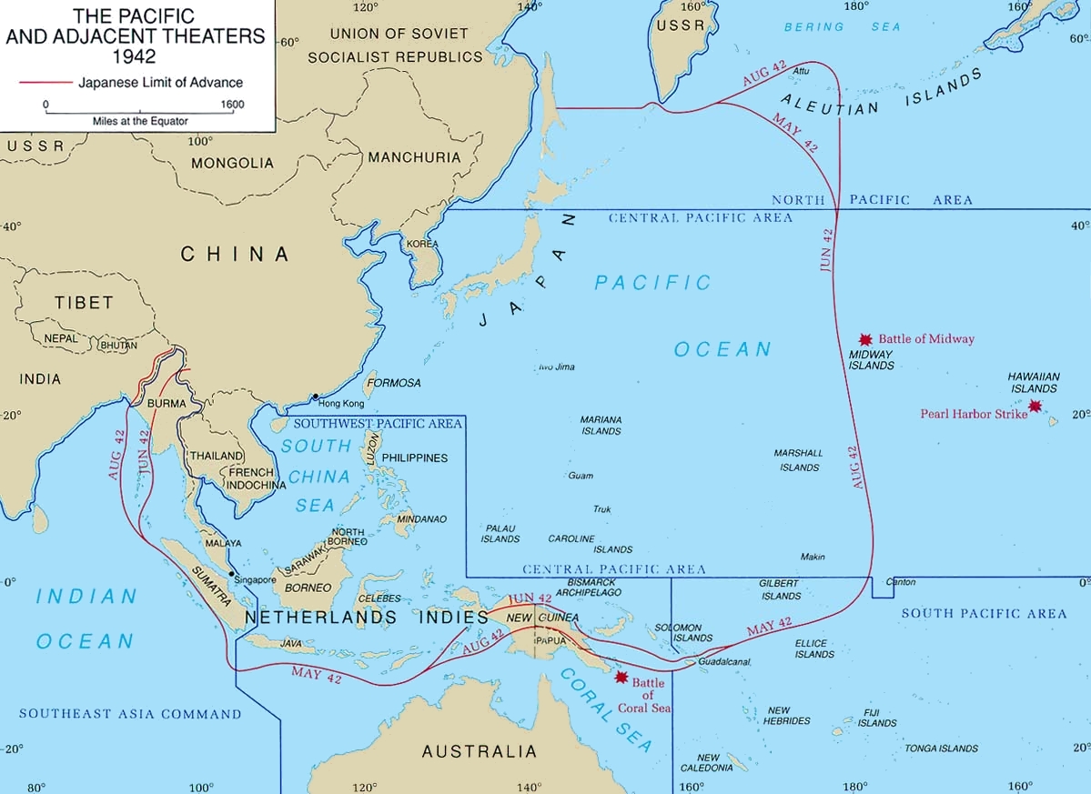
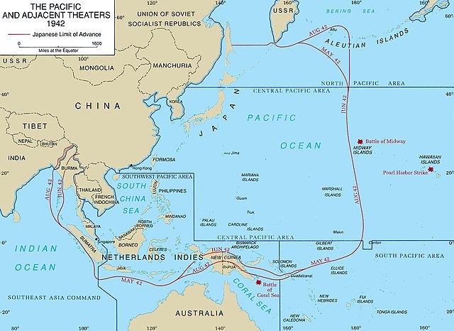
Map of Pacific theater of operations during World War II showing the boundaries of the Japanese Empire. Newell, Clayton R. (2003). Central Pacific. The US Army Campaigns of World War II. US Army Center of Military History. Archived from the original on 2012-02-02. Retrieved on 2008-08-06.
This file is a work of a U.S. Army soldier or employee, taken or made as part of that person's official duties. As a work of the U.S. federal government, it is in the public domain in the United States.
|
 |
Historian atkibu
Yemme' i fecha/ora para un li'e' i atkibu annai annok guihi na momentu.
| Fecha/Ora | Thumbnail | Mineddong | Muna'sesetbi | Komentu | |
|---|---|---|---|---|---|
| pa'go | 20:43, 18 Eneru 2018 | | 1,199 × 873 (351 KB) | Hohum | Cleanup |
| 21:06, 6 Matso 2005 |  | 1,199 × 873 (142 KB) | Wwoods | Pacific_Theater_Areas; http://www.army.mil/cmh-pg/brochures/72-4/72-4.htm {{PD-USGov-Military-Army}} |
Inachetton dokumento
Umachetton i sigiente na påhina yan este na atkibu:
Global file usage
The following other wikis use this file:
- Usage on br.wikipedia.org
- Usage on ca.wikipedia.org
- Usage on da.wikipedia.org
- Usage on de.wikipedia.org
- Usage on en.wikipedia.org
- Guadalcanal campaign
- Asiatic-Pacific theater
- South West Pacific Area
- Pacific Ocean Areas
- Cactus Air Force
- Invasion of Tulagi (May 1942)
- Kawaguchi Detachment
- Portal:Maps/Some special maps/Military
- Portal:Maps/Some special maps/Military/1
- Portal:Maps/Military/1
- Joint Army–Navy Assessment Committee
- User:Telecineguy/sandbox
- Louis Edward Curdes
- Naval Base Iwo Jima
- Naval Base Gilbert Islands
- Naval Base Marshall Islands
- US Naval Base Australia
- US Naval Base New Guinea
- United States naval bases in the Philippines
- US Naval Base Solomons
- US Naval Base Carolines
- Naval Base Samoa
- Naval Base Borneo
- Usage on en.wikibooks.org
- Usage on es.wikipedia.org
- Usage on eu.wikipedia.org
- Usage on fa.wikipedia.org
- Usage on fi.wikipedia.org
- Usage on fr.wikipedia.org
- Usage on he.wikipedia.org
- Usage on hu.wikipedia.org
- Usage on id.wikipedia.org
View more global usage of this file.